Los Indios
Los Indios is a city in Colombia with a population of about 0.
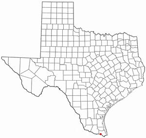
Los Indios is a U.S. border town in Cameron County, Texas. The population was 1,008 at the 2020 census. It is included as part of the Brownsville–Harlingen–Raymondville and the Matamoros–Brownsville metropolitan areas. The Free Trade International Bridge connects Los Indios with Matamoros, Tamaulipas.
🌦️ Live weather & local time
Loading live conditions…
About Los Indios
| Country | Colombia |
| Continent | South America |
| Explore | 12 |
| Population | 0 |
| Local currency | COP |
| Coordinates | 7.8000, -76.3833 |
| Time zone | America/Bogota |
🧭 Facts & curiosities
| Settlement type | Small town |
| Distance to the capital | 437 km · Bogota |
| Population (Colombia) | #1074 most populated in Colombia |
| Where on Earth | 7°47′60″N · 76°22′60″W |
| Hemisphere | N · W |
| Distance to the equator | 868 km |
| Distance to the North Pole | 9,151 km |
| Same latitude as | Osogbo (Nigeria) |
| Antipode (other side of Earth) | -7.80, 103.62 |
✈️ Distance to major cities
| New York | 3,667 km |
| São Paulo | 4,754 km |
| Los Angeles | 5,179 km |
| London | 8,380 km |
| Paris | 8,532 km |
| Moscow | 10,739 km |