Macanal
Macanal ist eine Stadt in Colombia mit etwa 0 Einwohnern.
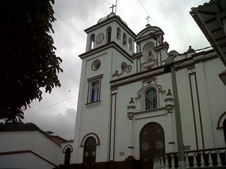
Macanal is a town and municipality in the Colombian Department of Boyacá, part of the subregion of the Neira Province. The urban centre is located in the Tenza Valley in the Eastern Ranges of the Colombian Andes at an elevation of 1,680.3 metres (5,513 ft) but parts of the municipality reach elevations of 2,500 metres (8,200 ft). It borders Campohermoso in the east, Almeida in the west, Garagoa in the north and Santa María and Chivor in the south.
🌦️ Live-Wetter & Ortszeit
Lade Live-Daten…
Über Macanal
| Land | Colombia |
| Kontinent | Südamerika |
| Entdecken | 15 |
| Bevölkerung | 0 |
| Lokale Währung | COP |
| Koordinaten | 2.7779, -67.9078 |
| Zeitzone | America/Bogota |
🧭 Fakten & Kuriositäten
| Siedlungstyp | Ortschaft |
| Entfernung zur Hauptstadt | 715 km · Bogotá |
| Bevölkerung (Colombia) | Nr. 1074 der bevölkerungsreichsten in Colombia |
| Wo es liegt | 2°46′40″N · 67°54′28″W |
| Hemisphäre | N · W |
| Entfernung zum Äquator | 309 km |
| Entfernung zum Nordpol | 9.710 km |
| Gleiche Breite wie | Boa Vista (Brazil) |
| Antipode (andere Seite der Erde) | -2.78, 112.09 |
✈️ Entfernung zu Großstädten
| São Paulo | 3.725 km |
| New York | 4.262 km |
| Los Angeles | 6.256 km |
| London | 8.246 km |
| Paris | 8.342 km |
| Moscow | 10.712 km |